Directions
From Sacramento
From Sacramento drive north on Interstate 5 to the town of Red Bluff. Once reaching Red Bluff, exit onto Hwy 36 toward Lassen and proceed 46 miles east on Hwy 36 to its intersection with Hwy 89. Turn left on Hwy 89 to access trailheads in Lassen Park. Continue on Hwy 89/36 to reach the Spencer Meadow National Recreation Trailhead at Childs Meadows. Or turn right on Hwy 172 to reach Hole In The Ground Campround and the upper Mill Creek trailhead.
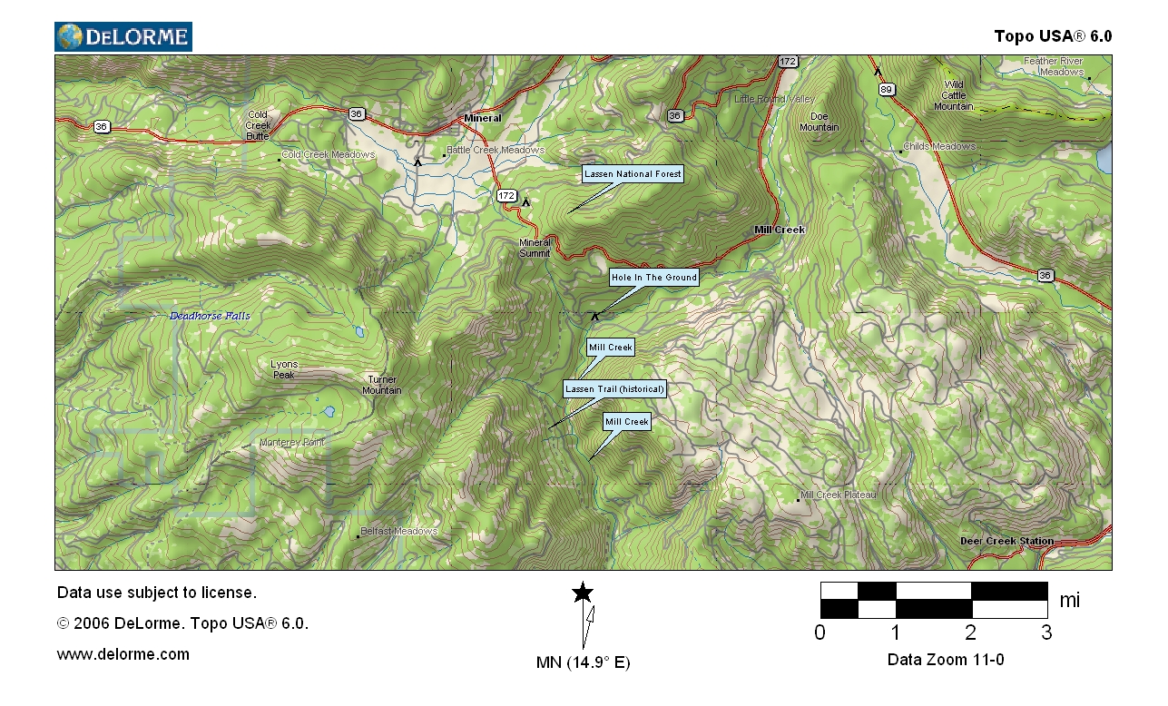
Fly Fishing Mill Creek (Lassen California)
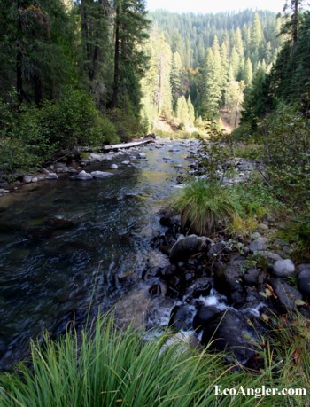
Melting snow and thermal springs from California's last active volcano - Mount Lassen - feed Mill Creek on its 49 mile journey through the northern Sierra Nevada to the Sacramento Valley.

In reality a small river, Mill Creek is probably best known as one of the last streams in the northern Sierra that still supports threatened spring run chinook salmon and winter steelhead. Most other Sierra rivers have been blocked by dams, but Mill Creek, and a handful of other Sacramento River tributaries (Battle Creek, Antelope Creek, Deer Creek, Big Chico Creek, and Butte Creek) still provides habitat for these migrating fish.
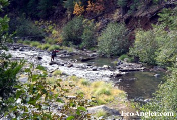
In fact, Mill Creek provides some of the best aquatic habitat in the entire mountain range. A congressionally mandated ecosystem study in 1996 found Mill Creek to possess the highest level of biotic integrity out of the 100 major watersheds in the Sierra Nevada, primarily due to its lack of dams, extensive roadless areas, and presence of native species such as spring run chinook salmon. The Mill Creek canyon also supports some of the most extensive stands of ancient forest in the northern Sierra. These forests provide critical habitat for the California spotted owl, wolverine, pine martin, and Pacific fisher.
An extensive trail system provides access to the headwaters of the creek and many thermal features in Lassen Volcanic National Park. Further downstream in the Lassen National Forest, the Spencer Meadow National Recreation Trail offers spectacular views of the Mill Creek canyon and Mt. Lassen, as the trail winds its way along a ridge heavily cloaked in old growth forest. Further downstream, an 18 mile trail follows Mill Creek through ancient forests of mixed conifers, oak woodlands, and finally the oak and grasslands that dominates the Ishi Wilderness
The Closing Chapter of the Yahi Indians on Mill Creek
Mill Creek was a favored route of the Yahi Indians, who hunted and camped along the canyon, following the salmon and deer migrations, as well as harvesting acorns. As more and more European settlers moved into the Sierra Nevada in pursuit of gold during the mid 1800's, the Yahi people came under attack. In one of the closing assaults on the Yahi Indians lead by R. Anderson, this tragedy befell them:
Waiting only until there was light enough of his men to see where they were shooting, Anderson directed a stream of gunfire down from above onto the sleeping village. As he has surmised, the Yahi ran downstream making for the open ford which brought them under Good's fire from below. The terrified Indians leapt into Mill Creek, but the rapid current was a sorry protection. They became targets there for Good's guns, and Mill Creek ran red with the blood of its people...
Ishi in Two Worlds by Theodora Kroeber
Some information provided by Friends of the River.