North Fork Mokelumne River

Directions
From Jackson
Important Update via Joshua Citrak...Ellis Road is closed about four miles in and has been for awhile. Joshua called the Amador ranger station and they said it might be open by Labor day 2013 and that going down to the Devil's Nose area one should take Panther Creek Road, which takes about an extra half hour.
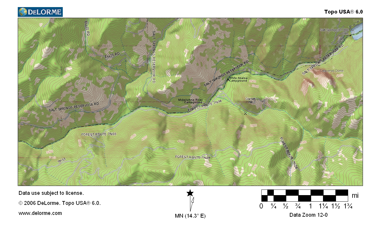
From the town of Jackson on Hwy 49, take Hwy 88 east past the small town of Pioneer. After Pioneer, look for Ellis Road (warning: there is only one sign before turn off). Turn right on Ellis Road, and take this winding but paved road to the National Forest campgrounds below Salts Springs dam along the North Fork of the Mokelumne River.
The North Fork of the Mokelumne River
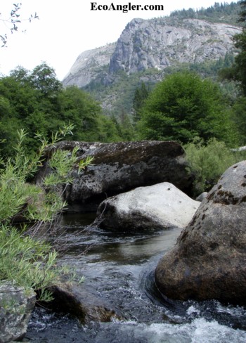
From its sources in the Sierra's Mokelumne and Carson-Iceberg Wilderness areas, the North Fork Mokelumne flows into Salt Springs reservoir. Below Salt Springs dam, the North Fork flows past scenic Calaveras Dome and several popular campgrounds. Here, the river canyon is studded with impressive granite rock formations and building-size boulders. This mid-elevation river segment is a popular destination for campers, swimmers, rock climbers, and anglers.
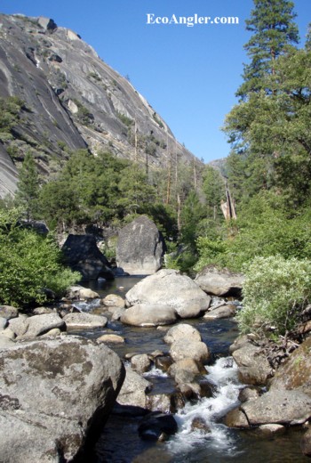
Beyond its confluence with the Bear River, the North Fork enters a truly wild canyon dominated by the brooding prominence of Devils Nose Peak. This virtually trackless river canyon is noted for its old growth forests, mid-elevation oak and riparian woodland, great natural bio-diversity, and wild trout fishery.
The entire North Fork canyon is also unique for its extensive high-quality archaeological values, which trace the history of the area's indigenous people back at least 2,500 years. More than 110 prehistoric and historic sites have been inventoried in the area, representing a full range of past human activities. The Forest Service established the Mokelumne Archaeological Special Interest Area in 1988 in recognition of the canyon's rich cultural value.
Trout Fishery Falls Short of Real Potential
My observation of this tailwater is the fishery takes a back-seat to the production of hydro-power at Salt Springs Dam. Watching the flows dramatically drop into the low 40's cfs range by late June, I wonder how aquatic eco-systems such as trout and insects deal with this unnatural reversal. It may explain the low numbers of stoneflies which "should" have been more evident, and both the small size and low numbers of trout which depend on this mid-season bounty.
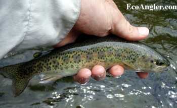
It's also not a stretch to imagine these low flows (with July flows in the low 20 cfs range), put stress on the fishery through the hot summer months. The North Fork of the Mokelumne shows potential to be a much healthier fishery. P.G.& E.and FERC have a responsibility to make this system reach it's true potential.
How Did We Get Here?
When P.G.&E. renewed it's license back in 1975, the California Department of Fish and Game recommended the following minimum instream flows below Salt Springs dam: In years of normal runoff, 40 cfs from May 1 to October 31 and 20 cfs from November 1 to April 30. In years of subnormal runoff, 20 cfs from May 1 to April 30 of the following year.
Flow Improvements Since 2000
Thanks to Katherine Evatt and Pete Bell of the Foothill Conservancy for their recent correspondence. Katherine wrote to update me on the new license agreement issued to P.G.& E. in 2001. Here's a summary:
The new PG&E license was based on a settlement agreement finalized in 2000. For a year prior to that, DFG, USFWS, Foothill Conservancy, Friends of the River, other agencies and other groups negotiated an entirely new flow regime with PG&E. That regime mimics the natural unimpaired hydrograph of the river, which includes lower flows in summer after the peak spring runoff. The license includes different flow requirements for different water year types, for each affected river reach.
Pete send along a table of the minimum stream flows from Salt Springs dam broken down by each of the five different "Water Years." As you can see, a more dynamic flow regiment with higher flows in May and June.
| Month | Continued Dry Year | Dry Year | Below Normal Year | Above Normal Year | Wet Year |
| Oct | 15 | 20 | 20 | 20 | 20 |
| Nov | 20 | 20 | 20 | 20 | 43 |
| Dec | 20 | 20 | 25 | 30 | 43 |
| Jan | 20 | 25 | 40 | 50 | 75 |
| Feb | 25 | 30 | 40 | 50 | 110 |
| Mar | 30 | 40 | 70 | 90 | 135 |
| Apr | 40 | 60 | 110 | 170 | 375 |
| May | 60 | 70 | 210 | 430 | 930 |
| June | 40 | 40 | 160 | 230 | 720 |
| July | 20 | 20 | 30 | 30 | 145 |
| Aug | 15 | 20 | 20 | 20 | 20 |
| Sept | 15 | 20 | 20 | 20 | 20 |
A big thanks to Katherine and Pete for detailing the new FERC license and continued success in their efforts to protect the Mokelumne.