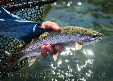
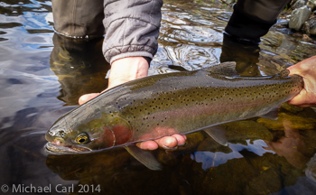
Goldfield Rainbows
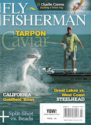
Look for my photography on California's Goldfield Bows in the June/July 2016 issue of FLY FISHERMAN .
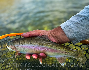
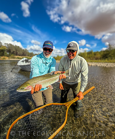
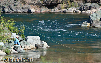
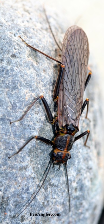
The Lower Yuba River's runs of wild steelhead trout and resident trout persist in a watershed that was driven like a rented mule. Despite the dams and massive hydraulic mining, aquatic insect hatches can be prolific. And where there is food, you'll find trout.
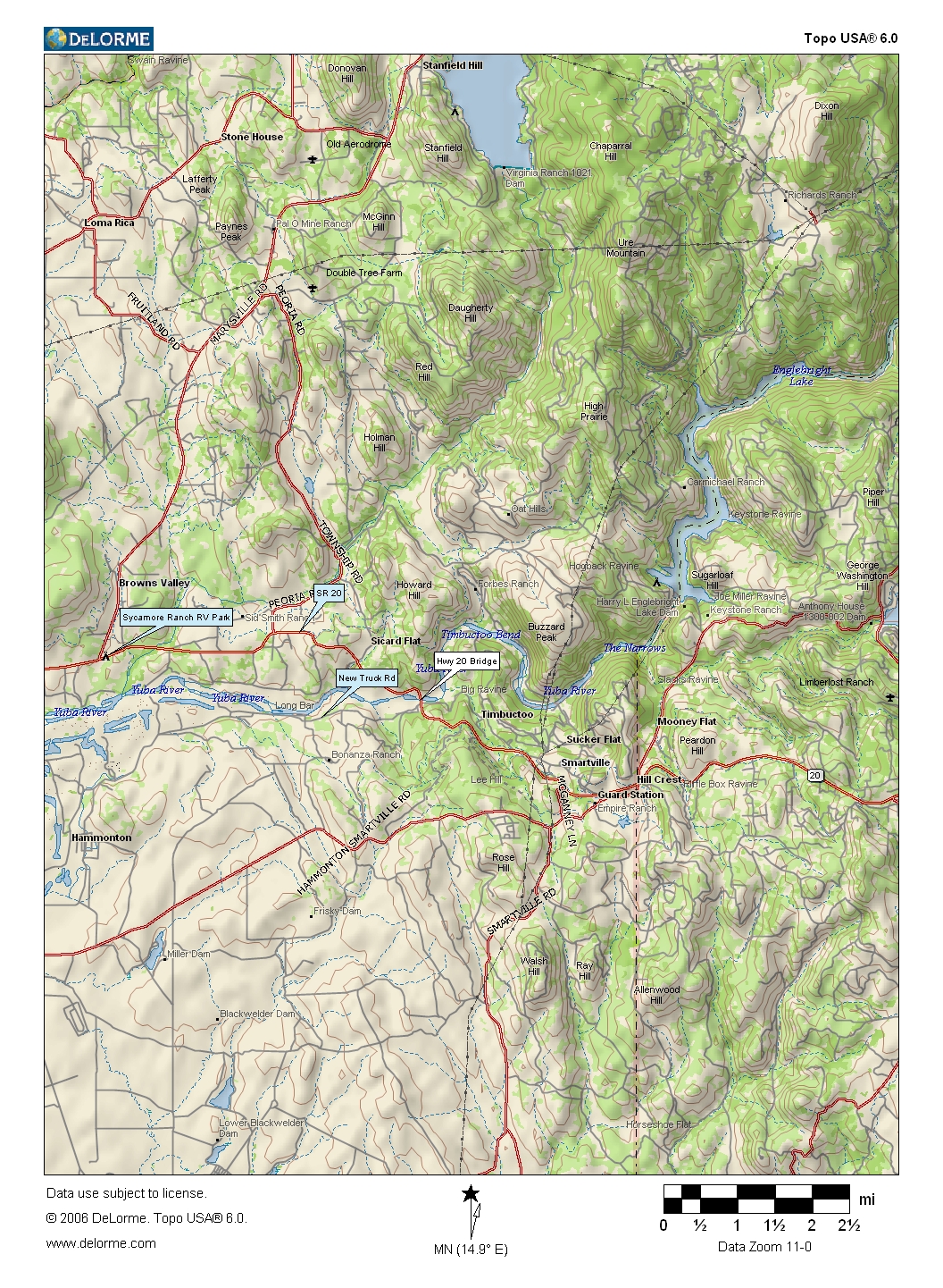
Directions
From Sacramento
From Sacramento take Interstate 5 north to Highway 99 and then follow Highway 99 all the way to Yuba City. From Yuba City follow the signs to Highway 20 and head east on Highway 20 for about 12 miles.
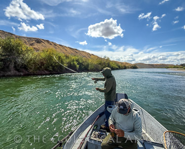
Fly Fishing Lower Yuba River
The Yuba River is located on the west side of the Sierra Nevada Mountains of northern California. The South, Middle, and North Forks of the Yuba make up the Yuba River Watershed. The watershed is bordered by the basins of the Feather River to the north, the Truckee River to the east, and the Bear River and American River to the south. The South Yuba begins with runoff near Donner Pass high in the Sierra Nevada. Its source is Lake Angela at 7,190 feet. The South Yuba runs for 64 miles before joining the other two forks at Englebright Reservoir to form the main stem of the Yuba. The flow stemming from the Englebright dam downstream is considered the Lower Yuba River.
Gold Discovery Puts the Yuba River on the Ropes
The Yuba River is home to some of California's last remaining runs of wild chinook salmon and steelhead trout. The discovery of gold in the Sierra Nevada in 1848 set in-motion habitat destruction on the Yuba on a grand scale. On the South Yuba at Malakoff Diggins, one of the largest hydraulic sites in the world, some 700,000 cubic feet of earth washed into the river. The total amount of material washed into the Yuba was more than triple the volume of earth excavated during construction of the Panama Canal. The deposits raised the riverbed by as much as 80 feet in some places causing major flooding on the main Yuba.
As the mine tailings travel in floods, they thicken streambeds and fill valleys with hundreds of feet of gravel. In their blanched whiteness, spread wide, these gravels will appear to be lithic glaciers for a length of time on the human scale that might as well be forever. ... By 1878 along the Yuba alone, eighteen thousand acres of farmland are covered. Mud, sand, cobbles--Yuba tailings and Feather River tailings spew ten miles into the Great Central Valley.
Assembling California by John McPhee
Next came the dams, blocking the Yuba and diverting its water for hydraulic mining operations. For decades, the Yuba ran thick with mud, silt, and rock as whole mountains were washed downstream. To trap the debris, two dams were built on the Yuba's main stem: Englebright Dam and Daguerre Point Dam. In man's quest for gold, a bill has come due. Once thriving populations of chinook and steelhead now adorn the pages of our state and federal Endangered Species list.
Wild Salmon and Steelhead Persist Against the Odds
Greatly reduced populations of salmon and steelhead trout continue to spawn in the lower Yuba, but the 260-foot Englebright Dam entirely blocks access to the upper watershed and hundreds of miles of potential spawning grounds. A dozen miles downstream of Englebright, the much smaller Daguerre Point Dam also impedes their passage. Daguerre is just 25- feet high and is equipped with fish ladders, but surveys indicate their design blocks migration for 50% of the native salmon and steelhead trout.
The Yuba River has the great misfortune of being the most diverted and dammed river in the Sierra. The effects of mining are still present in the form of mercury and arsenic contamination and sediment buildup. Studies by UC Davis show that the Yuba watershed has the most extensive contamination from introduced mercury and arsenic of any watershed in the Northern Sierra.
The Sierra Nevada Ecosystem Project ranked the Yuba River second-to-last for "Biotic Integrity" on the basis of aquatic community health; evidence of native fisheries; dams, reservoirs and diversions; and roads and roadless areas. Fire and logging also contribute sediment flows into the river. Elevated levels of Enterococcus bacteria were detected in the South Yuba during the summer of 2001, and the cause remains unknown.